Prof. Dr. Raquib Ahmed
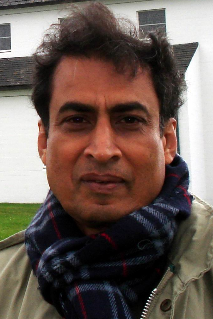
Prof. Dr. Raquib Ahmed
Südbau, Raum 0.16
Otto-Fischer-Straße 4
50674 Köln
Details
Dienstags von 14 bis 16 Uhr. Bitte tragen Sie sich in die Listen an der Tür ein.
Research Interests
Global change, remote sensing and GIS application in coastal environment study, land use change modeling, regional geography of South Asia, spatial data base modeling Currently engaged in research relating to; (i) regionalization process (South Asia) and possibility of future social and economic stability, (ii) Rohingya migration in to Bangladesh and its future consequences, (iii) organizing structure and materials for a book, ‘Geography of Bangladesh: A Critical Review’.Lectures
Involved in projects
- (2013-2016): Bangladesh Delta: Assessment of the Causes of Sea-level Rise Hazard and Integrated Development of Predictive Modelling Towards Mitigation and Adaptation, in collaboration with the University of Cologne, Germany under Band-Aid. Sub project Economic and social drivers of land use change in coastal Bangladesh” under DFG funding project
- (2012-2016): Co-leader of bilateral pedagogic research, development and exchange initiative project on environment and geographic education in collaboration with the Freiburg University of Education in Germany.
- (2010-2013): Team leader, Extension, updradation and renovation of optical fiber back bone campus network and development of automated office management system. Sponsor, UGC and World Bank. Cost US$ 550,000 (Taka 46,000,000).
- (2008-2009): Analyzing the change of land cover/land use pattern and management of rangeland in lesser Cholistan desert in Pakistan using satellite remote sensing”, sponsor, The Islamia University of Bahawalpur, Pakistan.
- (2007): Application of remote sensing in coral ecosystem change monitoring. Sponsor, Center for Disaster Management, Department of Geography and Environment, Dhaka University, Bangladesh.
- (2007-2008): Mapping underwater coral ecosystem change around St. martin’s island: towards development of an alternative method, Sponsor, Rajshahi University.
- (2006): Land Resource Assessment of the Coastal and Off Shore Islands in Bangladesh: A Study using Remotely Sensed Data”, Sponsor, University of Rajshahi, Bangladesh.
- (1998-2001): Project Director, Construct, Install and Operationalize a Fiber Optics Backbone based LAN for the Rajshahi University Campus (Campus Network) to connect 42 departments, all academic institutes and faculties. Cost about US $ 56,000 (Tk 2,500,000). Sponsor, Ministry of Science and Technology, Government of Bangladesh, 2001
- (2000): Application of GIS in Urban Cadastral and Facilities Management: A Study on Rajshahi City, Sponsor; University of Rajshahi.
Selected published works
1. Bernzen, A., Maruf, A. A., Lin, A., Ahmed, R. (2016), Landnutzungswandel im Küstenraum von Bangladesh (original in German) (Land Use Change in Coastal Bangladesh, Land management on Community and Household Level), Geographische Rundschau 7-8, pp 16-22. 2. Ahmed, R. and Roy, C. (2015), An integrated approach to environmental management in Bangladesh, in Global Sustainability, in Global Sustainability: Cultural Perspectives and Challenges for Transdisciplinary Integrated Research (ed. Benno Werlen), Springer, pp 185-201. 3. Hassan, M.K., Khan, J.I., Ahmed, R., Hossain, M.M.A. (2014), Road structure analysis using GPS information, Proceedings of the International Conference on Electrical Information and Communication Technology, (Download fulltext) 4. Islam, S., Rana, M. P. and Ahmed, R. (2013), Environmental perception during rapid population growth and urbanization: a case study of Dhaka city, Environment, Development and Sustainability, 10.1007/s10668-013-9486-5. (Download fulltext) 5. Ahmed, B., Ahmed, R. and Zhu, Z., (2013), Evaluation of model validation techniques in land cover dynamics, ISPRS International Journal of Geo-Information, Vol. 2, No. 3, pp. 577-597. 6. Ahmed B. and Ahmed, R. (2012), Modeling urban land cover growth dynamics using multi-temporal satellite images: a case study of Dhaka, Bangladesh, ISPRS International Journal of Geo-Information, Vol. 1, No. 1, pp.3-31. 7. Rahman, M.M. and Ahmed, R. (2012), Urban data base management: an analysis in geographic perspective, Rajshahi City: Past and Present (in Bangla), Institute of Bangladesh Studies occasional publications, University of Rajshahi, Vol. 1, pp. 73-103. 8. Rahman, M.M. R. and Ahmed, R. (2012), Analysis, design and development of a GIS based municipal information system for Rajshahi City Corporation, Rajshahi City: Past and Present, Institute of Bangladesh Studies occasional publications, University of Rajshahi, Vol. 2, pp. 979-1008. 9. M. S. Islam and Ahmed, R. (Dec 2011), Land use change prediction in Dhaka City using GIS aided Markov Chain Modeling, Journal of Life and earth Science, University of Rajshahi, Bangladesh, Vol. 6, pp. 81-89. 10. Islam, M.S., Rahman, M.R., Shahabuddin, A.K.M. and Ahmed, R. (2010), ”Changes in wetlands in Dhaka City: trends and physico-environmental consequences”, Journal of Life Earth Science, University of Rajshahi, Vol. 5, pp. 37-42. 11. Islam, M.S., Ahmed, R., Shahabuddin, A.K.M. and Sheikh, A.H. (2009), appeared in May 2011), “Pattern of land use change and its dynamics of urban expansion in Dhaka City, Bangladesh”, the Journal of Geo-environment, University of Rajshahi, Bangladesh, Vol. 9, pp. 107-120.Gastprofessur gefördert vom DAAD aus Mitteln des Bundesministeriums für Bildung und Forschung (BMBF)
